Checked
Surrey neighbourhoods: a guide to the main areas
Surrey, British Columbia, Canada
A guide to the main areas of Surrey, British Columbia: the six town centres and City Centre, with boundaries, 2021 census population, housing, SkyTrain, libraries, recreation centres and parks.
Key information
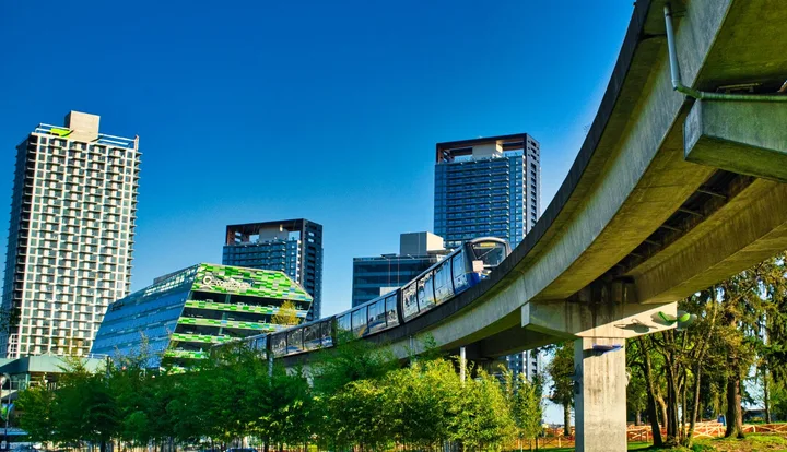
Surrey is made up of six town centres: Whalley (with City Centre, the downtown), Guildford, Fleetwood, Newton, Cloverdale and South Surrey. Newton has the most people (159,390 in 2021), South Surrey covers the most land, and City Centre is the densest, with high-rise apartments and SkyTrain. SkyTrain currently serves only Whalley and City Centre; the extension to Fleetwood, Cloverdale and Langley is expected in late 2029.
On this page
Surrey's communities at a glance
| Community | Population 2021 | Land area | Most common home type | Households renting | Take transit to work |
|---|---|---|---|---|---|
| Whalley | 77,360 | 3,131 ha | Row houses and townhouses (49%) | 41% | 20% |
| City Centre | 33,520 | 548 ha | High-rise apartments (45%) | 55% | 32% |
| Guildford | 64,985 | 4,421 ha | Single-detached houses (35%) | 31% | 14% |
| Fleetwood | 65,565 | 1,809 ha | Row houses and townhouses (52%) | 23% | 11% |
| Newton | 159,390 | 5,871 ha | Row houses and townhouses (52%) | 33% | 13% |
| Cloverdale (including Clayton) | 73,355 | 4,917 ha | Row houses and townhouses (46%) | 22% | 4.9% |
| South Surrey (including Grandview) | 88,445 | 11,375 ha | Single-detached houses (49%) | 20% | 4.3% |
| Surrey (whole city) | 562,635 | 32,621 ha | Row houses and townhouses (42%) | 30% | 13% |
Surrey is planned around six town centres: Whalley (with City Centre, Surrey's downtown), Guildford, Fleetwood, Newton, Cloverdale and South Surrey. The City's 2021 census profiles report City Centre separately from the rest of Whalley, so the table shows seven rows plus the city total.
Sources: Whalley Community Profile, 2021 Census Data, City of Surrey · City Centre Community Profile, 2021 Census Data, City of Surrey · Guildford Community Profile, 2021 Census Data, City of Surrey · Fleetwood Community Profile, 2021 Census Data, City of Surrey · Newton Community Profile, 2021 Census Data, City of Surrey · Cloverdale Community Profile, 2021 Census Data, City of Surrey · South Surrey Community Profile, 2021 Census Data, City of Surrey
How many people live in each part of Surrey?
- Whalley77,360 people
- City Centre33,520 people
- Guildford64,985 people
- Fleetwood65,565 people
- Newton159,390 people
- Cloverdale73,355 people
- South Surrey88,445 people
Newton is by far the largest community, with 28% of Surrey's people in 2021. City Centre is the smallest by population but grew fastest, by 24% from 2016 to 2021, while the city as a whole grew 10%.
Surrey has grown quickly since the census. BC Stats estimates Surrey's 2026 population at 733,760, and projects 955,249 by 2046. The City is updating its community-level projections.
Sources: Newton Community Profile, 2021 Census Data, City of Surrey · City Centre Community Profile, 2021 Census Data, City of Surrey · Population Estimates and Projections, City of Surrey
The six town centres and City Centre
Each area below has its boundaries, housing, transit, recreation centres, libraries and main parks. Figures are from the City of Surrey's 2021 census community profiles.
Whalley
13750 88 Avenue, Surrey, BC
Whalley is one of Surrey's oldest neighbourhoods and surrounds City Centre. It is named after Arthur Whalley, who settled near King George Boulevard and 108 Avenue in 1925. It includes older areas such as Bridgeview and the riverside industrial lands of South Westminster.
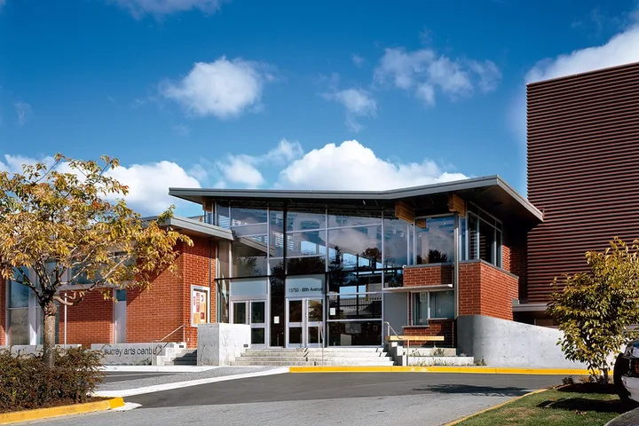
Outside City Centre, row houses and townhouses are the most common homes (49% of dwellings in 2021), and 41% of households rent. Four Expo Line SkyTrain stations serve the wider area: Scott Road, Gateway, Surrey Central and King George. Major parks include Bear Creek Park with the Surrey Arts Centre, Green Timbers Urban Forest and Whalley Athletic Park.
- Where it is
- Northwest corner of Surrey. The Fraser River forms the north and west edges, Newton is to the south, and much of the east edge runs along 144 Street.
- Population (2021, outside City Centre)
- 77,360
- Land area
- 3,131 ha
- Most common home type
- Row houses and townhouses (49%)
- Households renting
- 41%
- Take transit to work
- 20%
- SkyTrain
- Scott Road, Gateway, Surrey Central, King George (Expo Line)
- Recreation
- North Surrey Sport & Ice Complex, Chuck Bailey Recreation Centre, Bridgeview Community Centre
- Library
- City Centre Branch, 10350 University Drive
- Parks
- Bear Creek Park, Whalley Athletic Park, Bridgeview Park, Green Timbers Urban Forest
The map point is a library or landmark inside the community, not the centre of its boundary.
Sources: Whalley, City of Surrey · Whalley Community Profile, 2021 Census Data, City of Surrey · Locations and Hours, Surrey Libraries
City Centre
10350 University Drive, Surrey, BC
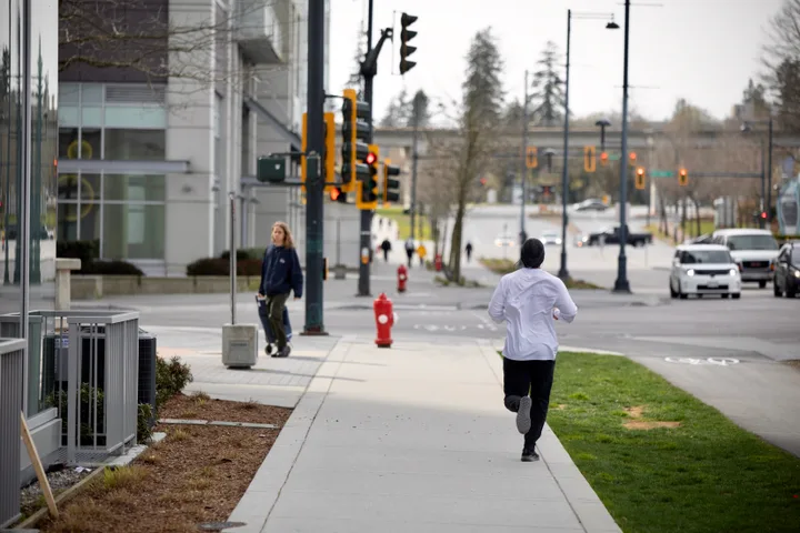
City Centre is Surrey's growing downtown, planned as a walkable, transit-oriented core. It has City Hall, Civic Plaza, the City Centre Library, SFU Surrey, KPU Civic Plaza, Surrey Memorial Hospital and Holland Park, where festivals are held.
It is the densest and fastest growing part of Surrey: its population grew 24% from 2016 to 2021. High-rise apartments make up 45% of homes, 55% of households rent and 32% of workers take transit to work. Surrey Central and King George SkyTrain stations are here.
- Where it is
- Between 132 Street and 140 Street, and from 94 Avenue north to 112 Avenue, inside the larger Whalley community.
- Population (2021)
- 33,520
- Growth 2016 to 2021
- 24%
- Land area
- 548 ha
- Most common home type
- High-rise apartments (45%)
- Households renting
- 55%
- Take transit to work
- 32%
- SkyTrain
- Surrey Central, King George
- Recreation
- Chuck Bailey Recreation Centre, North Surrey Sport & Ice Complex
- Library
- City Centre Branch
- Parks
- Holland Park, Forsyth Park
The map point is a library or landmark inside the community, not the centre of its boundary.
Sources: City Centre, City of Surrey · City Centre Community Profile, 2021 Census Data, City of Surrey · Locations and Hours, Surrey Libraries
Guildford
15105 105 Avenue, Surrey, BC
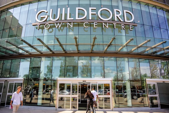
Guildford has mature neighbourhoods that grew up around Guildford Town Centre shopping centre, near 152 Street and 104 Avenue, and the newer Fraser Heights subdivision sloping to the Fraser River. Port Kells is the historic settlement in the area.
Single-detached homes are the most common type (35% of dwellings). Guildford has two large recreation centres, two Metro Vancouver regional parks (Tynehead and Surrey Bend), and quick access to Highway 1 and City Centre.
- Where it is
- Northeast corner of Surrey. The Fraser River is the north edge, Whalley is to the west and Langley to the east. The south edge runs from 96 Avenue to 84 Avenue.
- Population (2021)
- 64,985
- Land area
- 4,421 ha
- Most common home type
- Single-detached houses (35%)
- Households renting
- 31%
- Take transit to work
- 14%
- Recreation
- Guildford Recreation Centre, Fraser Heights Recreation Centre, Port Kells Outdoor Pool
- Libraries
- Guildford Branch (15105 105 Avenue), Port Kells Branch (18885 88 Avenue)
- Parks
- Tynehead Regional Park, Surrey Bend Regional Park, Hjorth Road Park
The map point is a library or landmark inside the community, not the centre of its boundary.
Sources: Guildford, City of Surrey · Guildford Community Profile, 2021 Census Data, City of Surrey · Locations and Hours, Surrey Libraries
Fleetwood
15996 84 Avenue, Surrey, BC
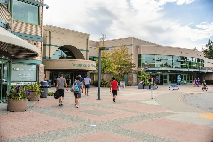
Fleetwood is the smallest of Surrey's town centres and one of the most recently developed. It is mostly residential, with many families. The City page describes mostly single-family homes, but the 2021 census profile shows row houses and townhouses as the largest share (52% of dwellings).
The Surrey Langley SkyTrain will connect Fleetwood to the Expo Line, with a Fleetwood station and service expected in late 2029. Fleetwood is named after Lance Corporal Arthur Thomas Fleetwood, whose family settled here in 1907.
- Where it is
- Centre of the northern half of Surrey, with Whalley to the west, Newton and Cloverdale to the south, and Guildford to the east and north.
- Population (2021)
- 65,565
- Land area
- 1,809 ha
- Most common home type
- Row houses and townhouses (52%)
- Households renting
- 23%
- Take transit to work
- 11%
- Future SkyTrain
- Fleetwood station, expected late 2029
- Recreation
- Surrey Sport & Leisure Complex, Fleetwood Community Centre
- Library
- Fleetwood Branch, 15996 84 Avenue
- Parks
- Fleetwood Park and Gardens, Surrey Lake Park, Freedom Dog Park
The map point is a library or landmark inside the community, not the centre of its boundary.
Sources: Fleetwood, City of Surrey · Fleetwood Community Profile, 2021 Census Data, City of Surrey · Locations and Hours, Surrey Libraries
Newton
13795 70 Avenue, Surrey, BC
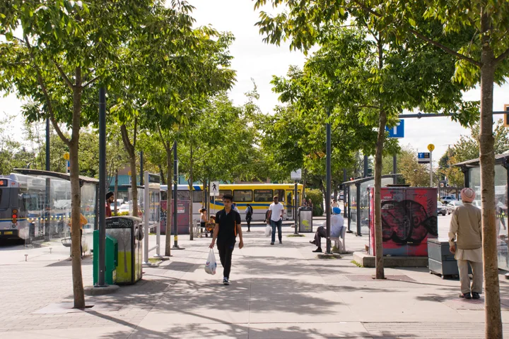
Newton is Surrey's most populous community, with 159,390 people in 2021 (28% of the city). It is home to the region's largest South Asian community and one of the largest Vaisakhi parades outside India. It includes the historic village of Sullivan and the Panorama neighbourhood.
Newton has Surrey's largest supply of industrial land and Kwantlen Polytechnic University's main campus. Row houses and townhouses make up 52% of homes. A new Newton Community Centre is planned beside the Newton Seniors Centre on King George Boulevard.
- Where it is
- Delta is to the west, Mud Bay and South Surrey to the south, 160 Street to the east, and Whalley and Fleetwood to the north.
- Population (2021)
- 159,390
- Land area
- 5,871 ha
- Most common home type
- Row houses and townhouses (52%)
- Households renting
- 33%
- Take transit to work
- 13%
- Recreation
- Newton Recreation Centre, Newton Arena, Newton Seniors Centre, Bell Performing Arts Centre
- Library
- Newton Branch, 13795 70 Avenue
- Parks
- Newton Athletic Park, Unwin Park, Mud Bay Park
The map point is a library or landmark inside the community, not the centre of its boundary.
Sources: Newton, City of Surrey · Newton Community Profile, 2021 Census Data, City of Surrey · Locations and Hours, Surrey Libraries
Cloverdale (including Clayton)
5642 176A Street, Surrey, BC
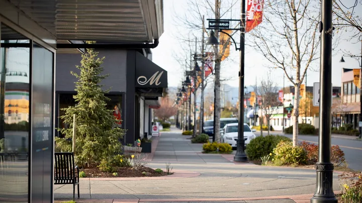
Cloverdale is Surrey's historic centre, with a western and railway main street, the Museum of Surrey and the Surrey Archives. It hosts the Cloverdale Rodeo and Western Canada's largest Canada Day celebration. Newer areas like Clayton Heights have grown quickly, and the City now also describes Clayton as its own community.
Row houses and townhouses are the most common homes (46%), and 82% of residents speak English at home. Three Surrey Langley SkyTrain stations are planned for the area. The Clayton Community Centre at 7155 187A Street combines recreation, arts and a library.
- Where it is
- West edge along 160 Street, south edge along 48 Avenue, Langley to the east, and Guildford and Fleetwood to the north (along 84 Avenue and 76 Avenue).
- Population (2021)
- 73,355
- Growth 2016 to 2021
- 12%
- Land area
- 4,917 ha
- Most common home type
- Row houses and townhouses (46%)
- Households renting
- 22%
- Take transit to work
- 4.9%
- Recreation
- Clayton Community Centre, Cloverdale Recreation Centre, Cloverdale Arena, Don Christian Recreation Centre
- Libraries
- Cloverdale Branch (5642 176A Street), Clayton Branch (7155 187A Street)
- Parks
- Cloverdale Athletic Park, Hazelgrove Park, Hi-Knoll Park, Clayton Dog Off-Leash Park
The map point is a library or landmark inside the community, not the centre of its boundary.
Sources: Cloverdale, City of Surrey · Cloverdale Community Profile, 2021 Census Data, City of Surrey · Locations and Hours, Surrey Libraries
South Surrey (including Grandview)
1815 152 Street, Surrey, BC
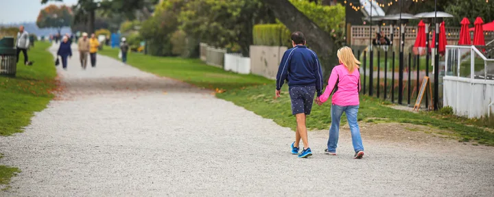
South Surrey is the largest community by land area (11,375 ha), with beaches, farmland and two border crossings to the United States (Peace Arch and Pacific Highway). Neighbourhoods include Crescent Beach, Grandview Heights, Darts Hill, Rosemary Heights, Campbell Heights and Semiahmoo Town Centre, its commercial heart. The City now also describes Grandview as its own community.
The average age is 44, five years older than the city average, and single-detached houses are the most common home (49%, compared with 33% citywide). Only 4.3% of workers take transit to work, the lowest of any community.
- Where it is
- The ocean is to the west, White Rock and the United States border to the south, Langley to the east, and 48 Avenue to the north.
- Population (2021)
- 88,445
- Growth 2016 to 2021
- 15%
- Land area
- 11,375 ha
- Most common home type
- Single-detached houses (49%)
- Households renting
- 20%
- Take transit to work
- 4.3%
- Recreation
- South Surrey Recreation & Arts Centre, Grandview Heights Aquatic Centre, South Surrey Indoor Pool
- Libraries
- Semiahmoo Branch (1815 152 Street), Ocean Park Branch (12854 17 Avenue)
- Parks
- Redwood Park, Elgin Heritage Park, South Surrey Athletic Park, Crescent Beach
The map point is a library or landmark inside the community, not the centre of its boundary.
Sources: South Surrey, City of Surrey · South Surrey Community Profile, 2021 Census Data, City of Surrey · Locations and Hours, Surrey Libraries
Sources: Our Communities, City of Surrey
Map of Surrey communities
Location data: Our Communities, City of Surrey. Google Maps displays one selected place at a time. An inventory position may be inside a site rather than at its visitor entrance.
Sources: Our Communities, City of Surrey · Locations and Hours, Surrey Libraries
SkyTrain and transit by area
- Today, Surrey's SkyTrain stations are all on the Expo Line in Whalley and City Centre: Scott Road, Gateway, Surrey Central and King George.
- The Surrey Langley SkyTrain will run 16 kilometres along an elevated guideway from King George Station to 203 Street in Langley City, with eight stations: Green Timbers, 152 Street, Fleetwood, Bakerview-166 Street, Hillcrest-184 Street, Clayton, Willowbrook and Langley City Centre. Service is expected in late 2029.
- In 2021, the share of workers taking transit to work ranged from 32% in City Centre to 4.3% in South Surrey (13% citywide).
- Newton has a bus exchange on King George Boulevard. For fares and passes, see the TransLink fares guide.
Sources: Whalley, City of Surrey · Surrey Langley SkyTrain project, Government of British Columbia · City Centre Community Profile, 2021 Census Data, City of Surrey · South Surrey Community Profile, 2021 Census Data, City of Surrey · Newton, City of Surrey
Why does the City also mention Clayton and Grandview?
The City's Our Communities page now describes eight communities: Clayton, Cloverdale, Fleetwood, Guildford, Grandview, Newton, South Surrey and Whalley (City Centre). Clayton is in northeast Surrey next to Langley, and Grandview is in southeast Surrey.
The census profiles and population projections still use the six traditional communities plus City Centre, so this guide counts Clayton as part of Cloverdale and Grandview as part of South Surrey.
Sources: Our Communities, City of Surrey · Clayton, City of Surrey · Grandview, City of Surrey · Population Estimates and Projections, City of Surrey
Schools and post-secondary campuses
- Public schools are run by Surrey Schools (School District 36). Use its school locator to find the school for your address, and see the registration guide for steps.
- SFU Surrey and KPU Civic Plaza are in City Centre. Kwantlen Polytechnic University's main campus is in Newton.
- Newton's first high school, Princess Margaret Secondary, opened in 1951, followed by Frank Hurt Secondary in 1973.
- In South Surrey, the City is planning a new community park next to the new Grandview Heights Secondary School.
Sources: School Locator, Surrey Schools · City Centre, City of Surrey · Newton, City of Surrey · South Surrey, City of Surrey
Scope, sources and gaps
Scope: the six town centres and City Centre as used in the City of Surrey's 2021 census community profiles, plus the two newer community pages (Clayton and Grandview). The guide does not cover crime, school rankings or house prices.
Conflicts: the Cloverdale profile shows 75,355 people on its summary page but 73,355 in its text. The second figure is used because the seven community totals then add up to the city total. The Fleetwood community page says homes are mostly single family, but the 2021 profile shows row houses and townhouses are the largest share.
Gaps: Strawberry Hill Branch (7399 122 Street) is not named on any community page, so it is not assigned to an area here. Community-level population estimates after 2021 are being updated by the City.
Sources: Cloverdale Community Profile, 2021 Census Data, City of Surrey · Fleetwood Community Profile, 2021 Census Data, City of Surrey · Locations and Hours, Surrey Libraries · Population Estimates and Projections, City of Surrey
Questions about Surrey neighbourhoods
What are the main areas of Surrey?
Surrey's six town centres are Whalley (including City Centre), Guildford, Fleetwood, Newton, Cloverdale and South Surrey. The City now also describes Clayton and Grandview as communities.
Source: Our Communities, City of Surrey
What is the population of Surrey?
BC Stats estimates Surrey's 2026 population at 733,760. The 2021 census counted 562,635.
Source: Population Estimates and Projections, City of Surrey
Which part of Surrey has the most people?
Newton, with 159,390 people in 2021, or 28% of Surrey's population.
Source: Newton Community Profile, 2021 Census Data, City of Surrey
Which part of Surrey is the biggest by land area?
South Surrey, at 11,375 hectares of the city's 32,621 hectares.
Source: South Surrey Community Profile, 2021 Census Data, City of Surrey
Where is downtown Surrey?
City Centre runs from 132 Street to 140 Street and from 94 Avenue to 112 Avenue, inside the Whalley community.
Source: City Centre, City of Surrey
Which Surrey neighbourhoods have SkyTrain?
Whalley and City Centre, with four Expo Line stations: Scott Road, Gateway, Surrey Central and King George.
Source: Whalley, City of Surrey
When will SkyTrain reach Fleetwood and Clayton?
The Surrey Langley SkyTrain, with stations including Fleetwood and Clayton, is expected to open in late 2029.
Source: Surrey Langley SkyTrain project, Government of British Columbia
Which part of Surrey has the most renters?
City Centre, where 55% of households rented in 2021, compared with 30% citywide.
Source: City Centre Community Profile, 2021 Census Data, City of Surrey
Which part of Surrey grew fastest?
City Centre grew 24% from 2016 to 2021, compared with 10% for the whole city.
Source: City Centre Community Profile, 2021 Census Data, City of Surrey
What kind of homes are most common in South Surrey?
Single-detached houses: 17,050 homes, or 49% of dwellings in 2021, compared with 33% citywide.
Source: South Surrey Community Profile, 2021 Census Data, City of Surrey