Checked
About Surrey: a newcomer and visitor guide
Surrey, British Columbia, Canada
What to know about Surrey, British Columbia: where it is, how fast it is growing, its town centres, SkyTrain and transit, jobs, weather, languages, hospitals, schools and landmarks.
Key information
Surrey is a city of 568,322 people (2021 Census) south of the Fraser River, bordering the United States, on the traditional, ancestral and unceded territories of the Katzie, Kwantlen and Semiahmoo Nations. It is the largest city in Metro Vancouver by land area, the second largest by population, and one of the fastest growing cities in Canada.
On this page
Where is Surrey?
Surrey is on the south side of the Fraser River in Metro Vancouver. New Westminster is across the river to the north, Delta to the west, the Township and City of Langley to the east, and Washington State to the south. The small City of White Rock sits on the coast inside Surrey's southern edge; it split off from Surrey in 1957.
At 316.11 square kilometres, Surrey is the biggest city in Metro Vancouver by land area, nearly three times the size of the City of Vancouver. A lot of that land is still farms, forest and floodplain: the City describes itself as a mix of urban areas and significant agricultural and rural land.
The City states that Surrey is situated on the traditional, ancestral and unceded territories of the Salish Peoples, including the q̓ic̓əy̓ (Katzie), q̓ʷɑ:n̓ƛ̓ən̓ (Kwantlen) and Semiahma (Semiahmoo) land-based nations. The History of Surrey guide explains more.
Sources: City of Surrey: About Surrey · Statistics Canada: Population and dwelling counts, 2021 Census (table 98-10-0002-01) · The Canadian Encyclopedia: Surrey
How many people live in Surrey?
| Measure | Number |
|---|---|
| Population, 2021 Census | 568,322 |
| Population, 2016 Census | 517,887 |
| Growth, 2016 to 2021 | 9.7% |
| Land area | 316.11 km² |
| People per km², 2021 | 1,797.9 |
| Immigrants, share of residents, 2021 | 45% |
| BC Stats estimate, July 1, 2025 | 703,531 |
The 2021 Census counted 568,322 people in Surrey, up 9.7% from 517,887 in 2016. That made it the second largest city in British Columbia and the 11th largest in Canada. Metro Vancouver as a whole grew 7.3% over the same years.
Surrey has kept growing fast since then. BC Stats estimates 703,531 residents on July 1, 2025, after estimated gains of 5.4% in 2023 and 5.8% in 2024. These are provincial estimates, not census counts, but they put Surrey within about 37,000 people of the City of Vancouver's estimate of 740,454.
Surrey is young and diverse. In 2021, 45% of residents were immigrants, and South Asian residents made up 38% of the population, according to the City's census profile.
Sources: Statistics Canada: Population and dwelling counts, 2021 Census (table 98-10-0002-01) · BC Stats: Population estimates for B.C. municipalities · City of Surrey: City of Surrey profile, 2021 Census data
What are the main areas of Surrey?
| Community | What it is known for |
|---|---|
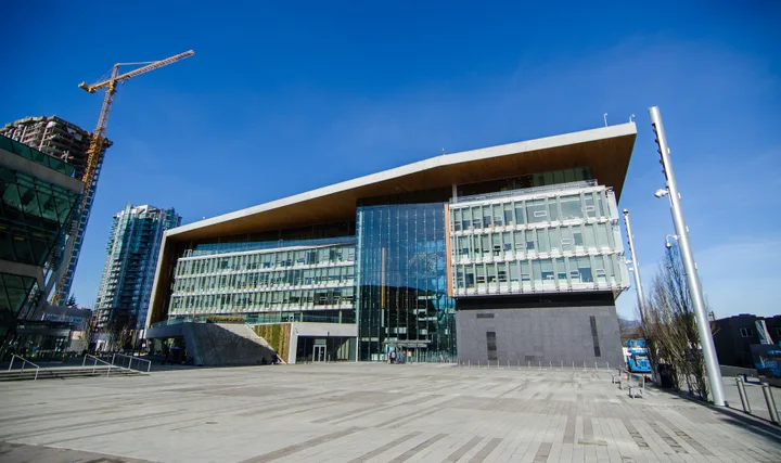
| City Centre and Whalley | The emerging second downtown of the region: City Hall, City Centre Library, SFU Surrey, KPU Civic Plaza, Surrey Memorial Hospital and two SkyTrain stations. |
| Guildford | Large recreation centres, Guildford Town Centre (the second largest shopping centre in B.C.) and views of the Port Mann Bridge. |
| Fleetwood | Surrey's newest town centre, mostly residential, with the Surrey Sport and Leisure Complex. |
| Newton | Surrey's most populous town centre, the region's largest South Asian community, KPU's main campus and the Vaisakhi Parade. |
| Cloverdale | Surrey's historic centre, with the Museum of Surrey, Surrey Archives, the fairgrounds and the Cloverdale Rodeo. |
| South Surrey | The largest town centre by land: Crescent Beach, farmland, Historic Stewart Farm and two border crossings. |
| Clayton and Grandview | Growing family neighbourhoods in the northeast and southeast, with new recreation centres and parks. |
Surrey grew as a collection of separate communities rather than around one downtown. The City's coat of arms still has five stars for the five original town centres, and the City's pages now list six or eight communities depending on the page: City Centre and Whalley, Guildford, Fleetwood, Newton, Cloverdale and South Surrey, plus the fast-growing areas of Clayton and Grandview.
Sources: City of Surrey: Our Communities · City of Surrey: City Centre · City of Surrey: Newton · City of Surrey: Cloverdale · City of Surrey: South Surrey · City of Surrey: History of Surrey, BC
How do people get around Surrey?
Surrey is spread out, and transit use is below the regional average. In 2021, 13% of employed residents took transit to work, compared with 15% across Metro Vancouver.
SkyTrain's Expo Line crossed the Fraser River into Surrey in 1990 on the SkyBridge and reached King George Station in 1994. Surrey has four stations: Scott Road, Gateway, Surrey Central and King George. TransLink buses connect at exchanges such as Surrey Central and Newton.
The Surrey Langley SkyTrain, a 16 km extension from King George along Fraser Highway to Langley City with eight new stations (Green Timbers, 152 Street, Fleetwood, Bakerview-166 Street, Hillcrest-184 Street, Clayton, Willowbrook and Langley City Centre), is under construction. The Province's current anticipated in-service date is late 2029.
Sources: City of Surrey: City of Surrey profile, 2021 Census data · The Canadian Encyclopedia: SkyTrain · The Canadian Encyclopedia: Surrey · Surrey Langley SkyTrain project (Province of B.C.)
What is the economy like in Surrey?
The biggest employment sectors are retail, health care and social assistance, construction, manufacturing, and accommodation and food services, according to The Canadian Encyclopedia. The City points to its farmland, a growing university district in City Centre and Metro Vancouver's largest supply of vacant industrial land.
Newton has Surrey's largest stock of serviced industrial land, with food and beverage, metal and furniture manufacturing, and Powertech Labs, one of the largest clean energy testing labs in North America. Big public employers include Fraser Health, which runs Surrey Memorial Hospital, the school district and the City. We did not find a current official ranking of the largest employers.
Sources: The Canadian Encyclopedia: Surrey · City of Surrey: About Surrey · City of Surrey: Newton · City of Surrey: South Surrey
What is the weather like in Surrey?
- Jan219 mm
- Feb137 mm
- Mar142 mm
- Apr125 mm
- May94 mm
- Jun74 mm
- Jul48 mm
- Aug49 mm
- Sep68 mm
- Oct167 mm
- Nov241 mm
- Dec197 mm
| Measure | January | July | November | Year |
|---|---|---|---|---|
| Precipitation | 219 mm | 48 mm | 241 mm | 1,562 mm |
| Rain | 204 mm | 48 mm | 238 mm | 1,521 mm |
| Snowfall | 15 cm | 0 cm | 3 cm | 41 cm |
| Days with 0.2 mm or more of precipitation | 19.8 | 7.7 | 20.3 | 178 |
Surrey has mild, wet winters and dry summers. The Surrey Kwantlen Park station recorded an average of 1,562 mm of precipitation a year in the 1981 to 2010 normals, noticeably wetter than Vancouver's airport (1,189 mm). November is the wettest month (241 mm) and July the driest (48 mm). Snowfall averaged about 41 cm a year.
That Surrey station did not record temperature normals. The nearest long-term record, at Vancouver International Airport in Richmond, shows a daily average of 4.1°C in January and 18.0°C in July. Treat those airport numbers as a rough guide for Surrey.
Sources: Environment and Climate Change Canada: Climate normals 1981 to 2010, Surrey Kwantlen Park · Environment and Climate Change Canada: Climate normals 1981 to 2010, Vancouver Int'l A
What languages are spoken in Surrey?
English is the main language of work and city services, and 62% of residents spoke English most often at home in 2021. Punjabi was next at 20%, the highest share of any large city in the region, followed by Mandarin (4%), Tagalog (2%) and Hindi (2%).
India was the top place of origin for recent immigrants: 46% of people who arrived between 2016 and 2021. Surrey is also home to 12,180 Indigenous residents, about 19% of Metro Vancouver's Indigenous population, and the City says Surrey has the largest urban Indigenous population in B.C.
Sources: City of Surrey: City of Surrey profile, 2021 Census data · City of Surrey: Supporting Urban Indigenous Leadership in Surrey
Where are the main hospitals and schools?
- Surrey Memorial Hospital in City Centre: the largest of Fraser Health's three regional hospitals, the second largest hospital in B.C., with the province's busiest emergency department.
- Kwantlen Polytechnic University: campuses in Surrey (Newton), Cloverdale and Civic Plaza, plus Richmond and Langley. About 20,000 students a year attend.
- Simon Fraser University's Surrey campus in City Centre is home to SFU's new Stephens Family School of Medicine, which planned an admitted class of 48 students for August 2026.
- Surrey Schools runs the public school system; see the registration guide below.
Sources: Fraser Health: Surrey Memorial Hospital · Kwantlen Polytechnic University: About KPU · SFU Stephens Family School of Medicine: Fall 2026 admission statistics · City of Surrey: City Centre
What is Surrey known for?
Big parks and big crowds. The City counts about 250 parks, from the second-growth forest of Green Timbers to Bear Creek Park's gardens and the beach at Crescent Beach. Newton's Vaisakhi Parade draws more than 400,000 people, one of the largest outside India, and Cloverdale hosts Western Canada's largest Canada Day celebration and the Cloverdale Rodeo, held since 1945.
Surrey is also known for the Peace Arch at the border, Cloverdale's role as "Smallville" on television, and its 2024 switch from the RCMP to the city's own Surrey Police Service.
Sources: City of Surrey: About Surrey · City of Surrey: Newton · City of Surrey: Cloverdale · BC Parks: Peace Arch Park · City of Surrey: Surrey policing transition
10 useful questions about Surrey
What is the population of Surrey, BC?
The 2021 Census counted 568,322 people. BC Stats estimated 703,531 on July 1, 2025.
Source: Statistics Canada: Population and dwelling counts, 2021 Census (table 98-10-0002-01)
Is Surrey bigger than Vancouver?
By land, yes: Surrey covers 316 km² and Vancouver 115 km². By population, Vancouver is still larger, 662,248 to 568,322 in the 2021 Census.
Source: Statistics Canada: Population and dwelling counts, 2021 Census (table 98-10-0002-01)
Is Surrey part of Metro Vancouver?
Yes. Surrey is one of 21 municipalities in Metro Vancouver and the largest by land area.
Source: City of Surrey: About Surrey
What are the town centres of Surrey?
City Centre and Whalley, Guildford, Fleetwood, Newton, Cloverdale and South Surrey, with Clayton and Grandview also listed by the City as communities.
Source: City of Surrey: Our Communities
Whose land is Surrey on?
The City says Surrey is on the traditional, ancestral and unceded territories of the Salish Peoples, including the Katzie, Kwantlen and Semiahmoo land-based nations.
Source: City of Surrey: About Surrey
Does SkyTrain go to Surrey?
Yes. The Expo Line has four Surrey stations: Scott Road, Gateway, Surrey Central and King George. An extension to Langley is due in late 2029.
What languages are spoken in Surrey?
In 2021, 62% of residents spoke English most at home and 20% spoke Punjabi, followed by Mandarin, Tagalog and Hindi.
Source: City of Surrey: City of Surrey profile, 2021 Census data
Does Surrey have its own police?
Yes. Surrey Police Service became the police of jurisdiction on November 29, 2024, with RCMP support continuing during the transition.
How rainy is Surrey?
The Kwantlen Park station averaged 1,562 mm of precipitation a year (1981 to 2010), with about 178 wet days.
Source: Environment and Climate Change Canada: Climate normals 1981 to 2010, Surrey Kwantlen Park
What is the biggest hospital in Surrey?
Surrey Memorial Hospital, the second largest hospital in B.C., with the busiest emergency department in the province.